


Title
Description
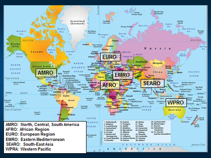
This is a world map showing the location of 6 different regions. AMRO for example is the "North Central South Americas" and consists of North America Central America and South America. The other regions are : African Region (AFRO) European Region (EURO) Eastern Mediterranean (EMRO) South-East Asia (SEARO) and Western Pacific (WPRA).
Type 
Category
-
Date
2014
Collection
We encourage you to view the image in the context of its source document(s) and cite the source(s) when using these images. However, to cite just this image alone, click the “Cite This Image” button and then paste the copied text.