


Title
Description
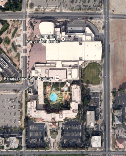
This is an aerial photograph of a city block in Palm Springs California with annotations intended for use as a map. It shows the location of the Renaissance Palm Springs Hotel (at the bottom) and how it is directly connected to the Palm Springs Convention Center (at the top). The location is bounded by North Calle Alvarado on the west East Amado Road on the north North Avenida Caballeros on the east and East Tahquitz Canyon Way on the south with parking lots and undeveloped land along the outer border of the image.
Type 
Category
Source 1 of 4
-
Date
2015
Collection
-
Date
2015
Collection
-
Date
2015
Collection
-
Date
2015
Collection
We encourage you to view the image in the context of its source document(s) and cite the source(s) when using these images. However, to cite just this image alone, click the “Cite This Image” button and then paste the copied text.